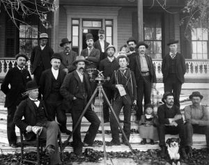
Famous Land Surveyors in American History

Land surveying has long been a rich part of our history and an important piece in the development of the United States.

Here is a list including America’s most famous land surveyors.

George Washington

America’s first president, George Washington, was one of the earliest land surveyors in the nation. He began his surveying career in 1749 at the age of 17. Soon after, he was appointed county surveyor of Virginia. Throughout Washington’s surveying career he surveyed over 200 plots of land and played a role contributing to the westward expansion.

Benjamin Banneker

Benjamin Banneker was an almanac author, surveyor, and scientist. In 1789, Banneker was hired as a surveyor by the U.S. Secretary of State, Thomas Jefferson. He became part of the crew that surveyed the original borders of Washington D.C., formerly known as District of Columbia.

Thomas Jefferson

Prior to becoming the 3rd president of the United States, Thomas Jefferson was a surveyor. In 1773, he was appointed as surveyor for Albemarle County in Virginia. Jefferson’s most recognized project was organizing the Lewis and Clark expedition. During this expedition, they explored and surveyed the land acquired through the Louisiana Purchase.

Daniel Boone

Notable pioneer and explorer, Daniel Boone, was an American land surveyor. During the late 18th century, Boone carried out most of his surveys resolving settler’s land title claims in Kentucky. During his surveying career, Boone performed over 160 surveys. However, due to his lack of education and training, Boone received a lot of criticism for the accuracy and quality of his surveys.

Abraham Lincoln

Another famous land surveyor was our 16th president Abraham Lincoln. He was able to master his survey training books and developed into a highly trusted surveyor because of his accuracy. In 1833, Lincoln was appointed deputy surveyor of Sangamon County, Illinois. During his career, Lincoln performed a multitude of surveys including, school sections, farmlands, roads, and was called on to settle boundary disputes.

America’s greatest presidents and pioneers were some of the nation’s most notable land surveyors. Early land surveyors made a substantial impact on the expansion and development of our nation. Today’s land surveyors continue to play an important role in the growth of our nation.

Call Windrose Land Services for any surveying or platting needs in Houston.

Land Surveying Through The Centuries

Because land surveying establishes boundaries and mapping, it is an essential part of land development and land ownership. Land mapping and measuring can date back to the ancient Egyptians and has paved the way for today’s surveying techniques and methods.

Earliest Land Surveyors

Earliest practices of land surveying can date back to the old civilization of the ancient Egyptians around 1400 B.C. They accomplished the construction of the great pyramids and waterways using primitive surveying tools, such as measuring ropes, plumb bobs, and other gadgets that assisted them in evaluating a parcel of land. Later, the Greeks and Romans created the groma which helped in dividing the land and building new roads and structures. This instrument was used to establish straight lines and right angles.

11th Century

In England in 1086, William the Conqueror commissioned the Domesday Book, also known as the Great Survey. This manuscript held an extensive record of each piece of land owned, its boundaries, elements on the land, the landholders and their tenants.  

18th Century

It wasn’t until the late 1700s that improvements to the earliest form of a theodolite, consisting of a tripod and compass, were made. Jesse Ramsden, a scientific instrument maker, designed and created a modern version of the theodolite. He designed it with the dividing engine that was capable of obtaining measurements and angles with high accuracy.

19th Century

During the 19th century, land surveying jobs became prominent. The industrial revolution caused an increase in the demand of surveyors because of the rapid expansion in developments.

Today

Early principles of measurement and surveying tools continue to be important in today’s practices. New technologies have improved the performance of older surveying instruments. New tools and methods like 3D scanning, GPS, and GIS Software have enhanced the efficiency and effectiveness of land surveying today.

Common Easements Affecting a Property

In many cases, there are restrictions on the usage of a property. Often parts of the property aren’t owned at all and this can come as a surprise to a buyer or builder.  Sometimes, years after purchasing a property, the owner decides to build a building or make other improvements only to then discover that it can’t be built due to legal restrictions on a property. Although not always top of mind, surveyors really should be one of the first firms you call to determine how much land there is and if there are any easements, setbacks or restrictions. 

How can this happen?

All properties have what is known as “easements”. Easements are designations that legally allow the city, public or utility companies  limited access to portions of a property.

However, it is important for the property owner to understand that even on easements you have reserved rights to use the land and deny access to individuals except for these easement holders. The individuals or entities that are allowed access you your property are known as “dominant estate”. The property owner who must share their property is known as “servient estate”.

Easements that commonly affect property owners

There are countless types of easements throughout the world, however here are the most common that can affect a property owner who wants to build or remodel on their land.

Utility Easements

In most cases, utility companies have access to your property above and below ground for maintenance or repair purposes. Utilities easement types include sanitary sewer, telephone, electric, gas, cable and more.

Drainage Easements

Typically, the city has limited rights of access and use of a property. In these areas, improvements are not allowed and are recommended to refrain from planting trees or landscaping. Drainage easements provide areas for storm water to flow or may be needed for access to the drainage infrastructures.


A right-of-way allows the public, access to your property such as sidewalk or driveway easements.

Sidewalk Easements

Amongst the most common, sidewalk easements typically allow the public access through the a property. Even when there is not a physical pavement in place, there still may be an easement in place.

Driveway Easements

When constructing on a lot, some properties do not border a road. In this case, an easement is created to provide road access through another lot.


When it comes to building an improvement near or in an easement there is some flexibility that a property owner is granted. However, dealing with these regulations can be burdensome. It is best to fully understand a property’s easement locations prior to purchasing or building on a property.

To determine the easements of a property one can look at the title documents received when the property was purchased or by ordering a survey. As surveyors, we specialize in the exact determination of property boundaries and any easements on those properties.

When you need a professional survey, trust Windrose Land Surveying & Platting to deliver accurately and on time.


Earliest Surveying Tools in History

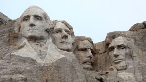
Land surveying is believed to be one of the oldest professions in history. The earliest forms of surveying are believed to date back to ancient civilizations of the Egyptians, Greeks, and Romans who created monumental structures like the Great Pyramids and Stonehenge.

Over the years many surveying tools and equipment have been replaced with new modern tools that are more time saving and accurate.


Here are 5 of the earliest surveying tools:


1.    Gunter’s Chain

 A measuring tool developed in the 1620’s. This chain consisted of 100 links and can reach up to about 66 feet. In practice, the links are pinned to the ground and were stretched out to define a path. Measurements would then be recorded until an endpoint was met.

2.    Gunter’s Surveyor Compass

 Also known as a circumferentor, this tool was used to determine right angles. This tool could determine two points at the same location allowing for the corners and boundaries of a parcel to be established.

3.    Zenith Telescope

 Constructed by Herman Wanschaff this tool was said to be the most sophisticated instrument in North America during the 18th century. This tool was used to had the capabilities of determining six parallels of latitude by observing the stars near zenith.


4.    Ramsden’s Theodolite

 This was a highly precise tool constructed in 1770 by Jesse Ramsden. This tool provided measurement indicators that made the way for highly accurate surveys and mapping.

5.    Solar Compass

1.    This gadget was created in 1853 by William Austin Burt to determine the true north direction with precise accuracy. This tool allowed for corners and boundaries to be established.

These surveying tools and equipment were pivotal to the development of the United States of America. It allowed boundaries to be established to create villages roads and provide land grants. Although many tools and methods like, GPS and 3-D scanning, have changed dramatically the principles of the surveying and mapping processes remain the same.


3 Fun Fall Trips in Texas Hill Country

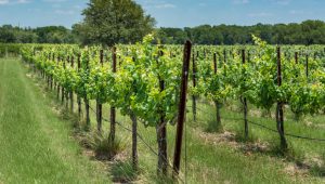
At Windrose, one of the best parts of our job is getting to see the beautiful landscapes across the Lone Star State and share our love for this natural beauty with others. One of our favorite parts of Texas is Hill Country. It is a beautiful place to visit year-round, but fall provides some particular delights. Though there are many places to enjoy, here are three places that are extra nice this time of year.

Experience Cultural Delight in Fredericksburg

Experience small-town charm in a picturesque setting when you visit Fredericksburg. German pioneers settled in the area over 160 years ago, and the spirit of their industriousness lives on today, with the community focused on building a better place to live. You can see this goal has been realized with the wonderful time the city shows its visitors. Whether you do a day trip or a weekend escape, you won’t be bored with the wide array of things to do. Try the top-rated Cabernet Grill, which offers mouth-watering steak, seafood, and more. When you’re not grabbing a bite to eat, take advantage of the scenic outdoor parks or historic museums. Making a weekend of it? Experience true Texas hospitality in one of their many bed and breakfasts.

Get Outdoorsy in Lost Maples State Natural Area

To get a glimpse at some of the gorgeous colors that fall can bring, take a trip to Lost Maples. Located just two hours northwest of San Antonio, the park offers plenty to do for the whole family. You can take it easy with a leisurely stroll along the grounds, taking in the beautiful sights of nature and snapping a few pictures while you’re at it. Or you can get more adventurous and go hiking, fishing, or camping. Over 10 miles of trails to explore means plenty of opportunity to view the many species of birds that make Lost Maples their home.

To see fall in its full splendor, you can check their Fall Foliage Color Report, which gives regular updates of what’s happening with the trees so visiting guests know what to expect. We’re just entering the best time to see some true fall colors, so plan your trip soon to get the best showing!

Sip and Be Merry at Hill Country Wineries

To get the best wine in the world, many people think of Tuscany or Napa Valley, but Hill Country has its own unique varietals to offer. Of the wine-producing states in the U.S., Texas ranks 5th, with 42 unique wineries in Hill Country, each offering something unique in terms of winemaking style. Because of the sunny, dry climate, Spanish and Italian varietals do well in this area. Try the Fredericksburg location of Messina Hof, which has nearly 10 acres with its own vineyard.

No matter what you do when you visit Hill Country, make sure you leave time to explore and just appreciate the natural beauty of the area. For land surveying needs closer to home in Houston, call Windrose Land Services today!

6 of the Most Beautiful Places in the World

As land surveyors, nothing captivates us more than the beauty of our world. From rocky mountains and towering trees to swaths of fields and glittering seas, the Earth’s terrain is vast and varied in its features. Each corner of the world has something unique to offer, so we’re exploring some of the most beautiful land in our world.

Bora BoraBask in the Beauty of Bora Bora

Some of the most striking land features are underwater, and this is certainly the case with the French Polynesian island Bora Bora, tucked in the stunning turquoise waters of the South Pacific. The terrain is composed of the main island of Bora Bora and the coral reef surrounding it in islets. Connecting the two is a breathtaking lagoon, said to be one of the most beautiful in the world.


HawaiiGet Volcanic On the Islands of Hawaii

All of the islands of Hawaii are distinctly striking, so it’s hard to choose just one to visit. Shaped from past oceanic volcanic eruptions, all six main islands offer stunning features such as active volcanoes, sea mountains and cliffs, rock spires, and more. Though the beaches are a sight to see, simply being in Hawaii and taking in the nature from lookout points scattered throughout the state’s national parks makes it worth the trip.


Zhangye Danxia, ChinaBe Awed By the Rainbow Mountains of Zhangye Danxia, China

The Rainbow Mountains of China look like something out of a dream, with their red, blue, and yellow striations. Centuries of tectonic shifts, climatic conditions, and the erosion of red terrigenous sedimentary beds have created this artist’s palette of beauty. They are understandably a popular tourist attraction and are worth a trip to glimpse their beauty in person.


 Iguazu FallsSee the Majestic Iguazu Falls of Brazil/Argentina

In the U.S., we have Niagara Falls, but Brazilians and Argentines share the beautiful Iguazu Falls, the largest waterfalls system in the world. The falls are twice as wide as those at Niagara, with 275 individual drops. They divide the river of the same name that serves as the boundary between Brazil and Argentina. Tourists can get up close for a glimpse thanks to the multiple trails.


Interlaken, SwitzerlandReach New Heights in Interlaken, Switzerland

Step into the chilly, snow-capped mountains of Switzerland with a jaunt to Interlaken, an outdoor enthusiast’s dream city. Interlaken sits between two lakes—hence the name—offering adventurers a plethora of thrilling entertainment. Here you can experience the beauty of the world at your fingertips, whether paragliding from the edge of a cliff, hiking winding trails, or taking a heart-pounding whitewater rafting ride.


Marble Caves in ChileMarvel at the Wonder of the Marble Caves in Chile

Another example of Earth’s natural creation of beauty, the Marble Caves in Chile are carved into the Patagonian Andes thanks to years of waves pounding against calcium carbonate, creating a solid marble peninsula that borders the remote glacial Lake General Carrera. Visit during different times of the year to see changes in intensity and hue. They are only accessible by boat, but the beauty will be worth the excursion.

For help with land closer to home, call Windrose Land Services for any surveying or platting needs in Houston. Let us know which gorgeous places you’d love to see!

Land Surveying Equipment

Any land surveyor will tell you that the most important component of our work are the dedicated people who bring professionalism and excellence to the field. Yet as much as our surveyors contribute to our success, we know that we could not do it without the help of surveying tools. We’ll outline some standouts, including some that have remained important throughout the years and a couple new advances that allow us to do more than we ever expected.

Basics: Theodolites and Total Stations

One of the oldest surveying tools on record is the theodolite, which over the years has been updated to adapt to modern needs. It is used for measuring angles in horizontal and vertical planes. The term theodolite has been found to be in use as far back as the 1500s, when the first one was built in Germany in 1576, complete with compass and tripod.

Today’s theodolites use a movable telescope mounted between two horizontal axes. This construction allows angles to be measured with great precision, to milliradian or seconds of arc. Today’s theodolites consist of “integrated electro-optical distance measuring devices, generally infrared based, allowing the measurement in one go of complete three-dimensional vectors.” These more advanced, “intelligent” electronic theodolites are also known as total stations, which are able to perform complex calculations and really help surveyors when mapping a property.

Advances in Technology: GPS and Drones

Surveying is all about helping people and doing it with the most efficiency. For this reason, surveyors were among the first to utilize GPS in our work as it enabled us to help more people faster and with better accuracy. GPS allows for accurate mapping and modeling of the physical world. What once took a team of surveyors weeks now can be accomplished in a day. GPS helps us collect GIS data, which facilitates many things, from Google Maps to disaster response, such as information on the recent Houston flooding from hurricane and tropical storm Harvey.

Finally, one of the most exciting technological developments in surveying are drones. They provide surveyors the ability to see and record information about areas not previously accessible. When equipped with sensors, they can measure information that can be transmitted back to surveyors. Drones offer multiple benefits including accessibility, low risk for surveyors, and high-quality images.

Windrose Land Services utilizes a variety of surveying equipment to bring top-notch mapping and surveying to commercial and residential clients across Houston, Dallas, and more. To see how we can help you with your next project, visit us online today!

Land Surveying in Highway Construction

Highways are essential in getting people where they need to go. They promote tourism and economic growth. As land surveyors, Windrose is proud to play a vital role in the development of roadways. However, we are only one player in a large group of people that get highways constructed. Let’s explore the history of the highway system, the steps to getting one underway, and some projects we’ve worked on in the past.

How It All Began

In 1956, President Eisenhower signed the Federal-Aid Highway Act of 1956 to create a 41,000-mile system of highways to promote safe and speedy travel. Over 60 years later, U.S. interstates now stretch over 46,000 miles long and serve as the route system for more than 250 million cars and trucks on the road.

How It All Comes Together

Building a roadway takes time because there are many steps involved in the process. Phase one is the planning phase, during which the transportation department meets with engineers, landscape architects, and others to determine what should be built and how it should be constructed. All of the involved parties use collected data to decide how to proceed.

The next phase is the design phase, and that is where land surveying companies like Windrose come in. Several different factors can influence the design of roadways, and we are here to uncover these things to ensure they won’t become a problem. Our team is able to collect accurate data along long stretches of expansion and communicate that data back to our RPLS and CAD teams enable the job to progress as new information comes in.

Thanks to new technology like GPS, this phase is now much shorter than it once was. GPS has eliminated the use of survey stakes to mark the road edges, and this more accurate way of marking boundaries helps the road stay in line with the design plans.

The final steps are the actual construction phases, which involve earthwork for a solid foundation and then paving for a smooth, safe driving surface.

Even after the road is completed, a surveyor’s job may not be done. In many cases, roadways will need additional surveys for changes, repairs, or renovations.

Our Experience

Windrose Land Surveying has been proud to work on a variety of highway projects in Texas, including stretches on US-59, Hardy Toll Road, FM 2100 expansion, and more. For a complete list of past transportation projects, see our portfolio.

For your commercial land surveying projects, give Windrose Land Surveying a call!

Drones: The Future of Surveying

The future is here. There won’t be any hovercars or commercial space travel anytime soon, but the use of drones in land surveying is become more and more of an industry technology.

What are drones?

Drones are small passenger-less aircrafts that are typically remote controlled, also called Unmanned Aerial Vehicles (UAV). They offer many uses like landscape film and photography, surveillance security, and delivering your next Amazon purchases.

What does this mean for land surveying?

While land surveying technology has increasingly developed over time, using drones may become the first option land surveyors use. While there are some setbacks like a long turnaround time for processing data, high costs, new training, and legal paperwork, drones can collect data so quickly that those disadvantages become marginal.

Eventually this technology could change the industry and make the process much more accurate and efficient.

What could this mean for us?

Using drones for land surveying can minimize risk to surveying teams when measuring dangerous sites such as mines, unstable slopes, and transport routes. The digital aerial images give more map versatility for topographical maps, heat maps, and more. Industry leaders even predict a 60% cost savings over conventional survey techniques.

In addition, drones could save surveyors time, leading to increased productivity. Large jobs that would usually take weeks to collect data would take just a matter of days for a drone. Because of this, surveyors would be able to handle more projects and focus efforts on extrapolating data.

We are excited to watch the future of land surveying unfold as new technology becomes available. At Windrose, our Houston surveyors are proud to use a variety of current technologies and instruments in order to obtain the most accurate measurements possible. Drones are something we’re looking forward to showcasing in the future!