
Because land surveying establishes boundaries and mapping, it is an essential part of land development and land ownership. Land mapping and measuring can date back to the ancient Egyptians and has paved the way for today’s surveying techniques and methods.
Earliest Land Surveyors
Earliest practices of land surveying can date back to the old civilization of the ancient Egyptians around 1400 B.C. They accomplished the construction of the great pyramids and waterways using primitive surveying tools, such as measuring ropes, plumb bobs, and other gadgets that assisted them in evaluating a parcel of land. Later, the Greeks and Romans created the groma which helped in dividing the land and building new roads and structures. This instrument was used to establish straight lines and right angles.
11th Century
In England in 1086, William the Conqueror commissioned the Domesday Book, also known as the Great Survey. This manuscript held an extensive record of each piece of land owned, its boundaries, elements on the land, the landholders and their tenants.
18th Century
It wasn’t until the late 1700s that improvements to the earliest form of a theodolite, consisting of a tripod and compass, were made. Jesse Ramsden, a scientific instrument maker, designed and created a modern version of the theodolite. He designed it with the dividing engine that was capable of obtaining measurements and angles with high accuracy.
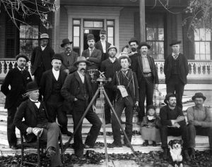
19th Century
During the 19th century, land surveying jobs became prominent. The industrial revolution caused an increase in the demand of surveyors because of the rapid expansion in developments.
Today
Early principles of measurement and surveying tools continue to be important in today’s practices. New technologies have improved the performance of older surveying instruments. New tools and methods like 3D scanning, GPS, and GIS Software have enhanced the efficiency and effectiveness of land surveying today.